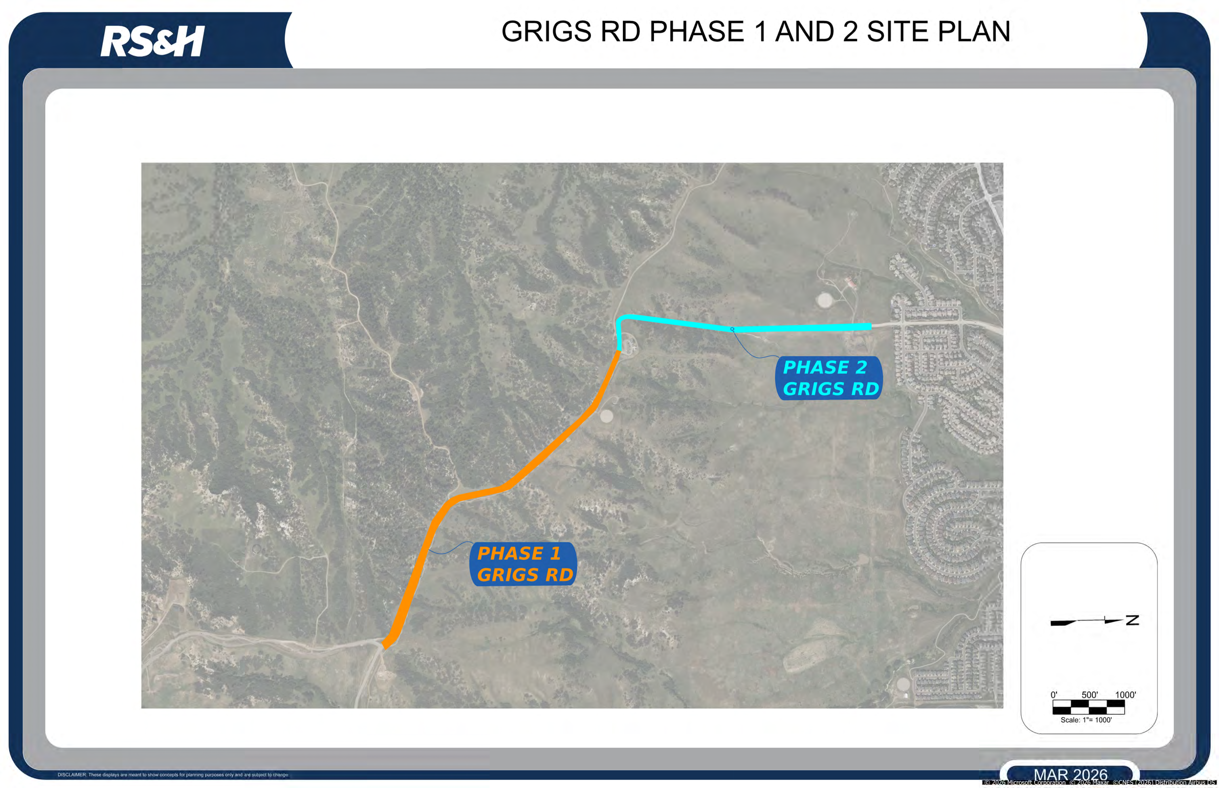
Project Overview
Grigs Road, a key link between Highlands Ranch and Daniels Park/Castle Pines, is undergoing improvements in two phases. Douglas County engineering staff is managing the project and is collaborating with staff from the Highlands Ranch Metro District and the Highlands Ranch Community Association. The design engineer is RS&H.
Phase One
Phase one added asphalt pavement and drainage upgrades along the first 0.8 miles from Daniels Park Road toward the East-West Connector trailhead.
Phase Two
Phase two will extend the work by connecting phase one to the existing concrete pavement to the north, completing the remaining mile of the 1.8-mile corridor.
Scope
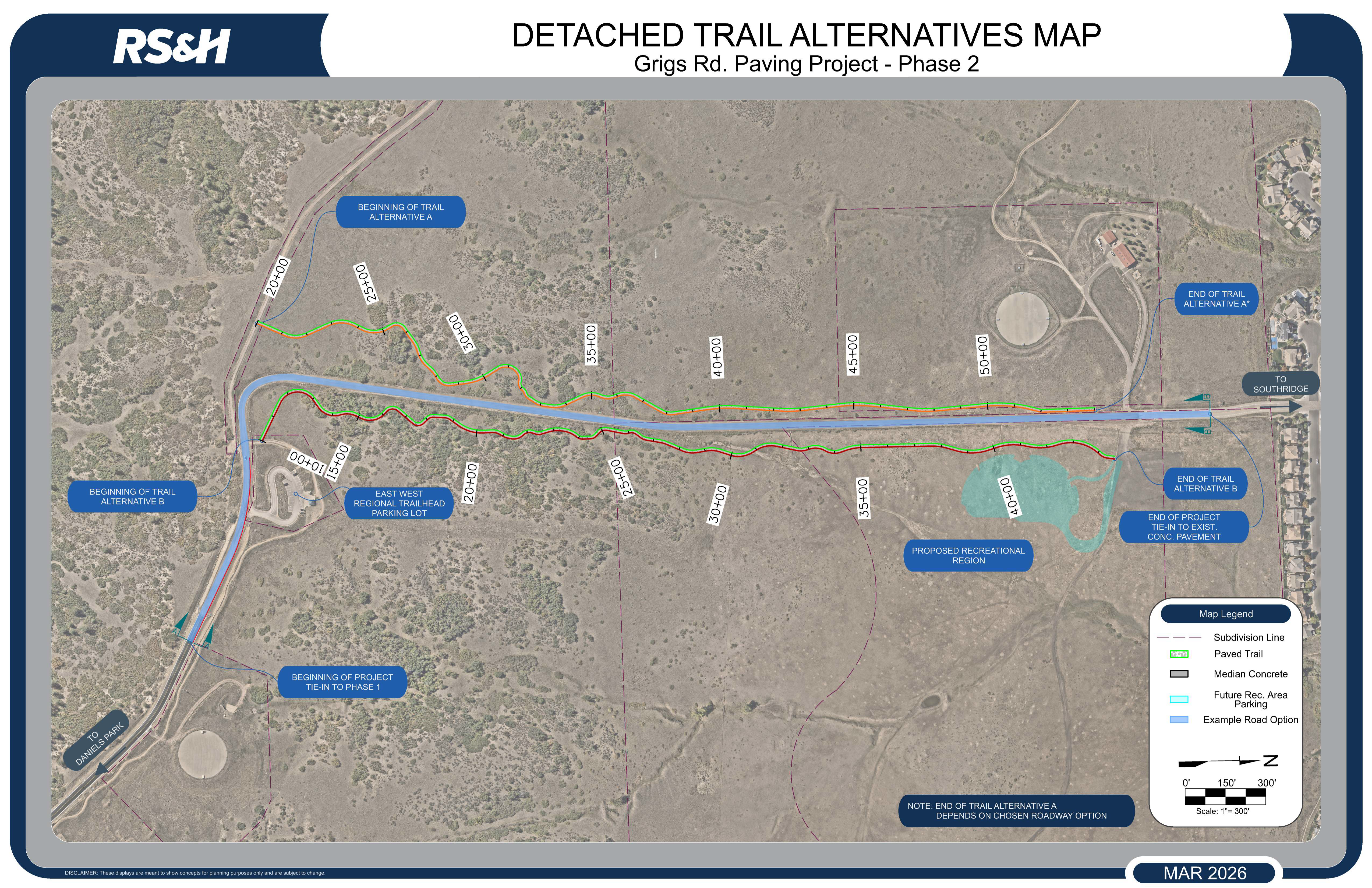
- The Grigs Road Phase 2 project will include construction of a 24-foot-wide asphalt roadway with curb and gutter, drainage improvements, and safety enhancements to address curves and steep slopes near the trailhead.
- The benefits of paving the gravel road are to improve driver safety, including stopping distance, to reduce required maintenance, and to reduce airborne particulates.
- Additional improvements include a roundabout at the future entrance to Wildcat Regional Park and a shared-use trail for pedestrians and bicyclists to improve connectivity and safety.
- As part of the design process, wildlife movements in the corridor will be evaluated and safety measures will be recommended.
Schedule
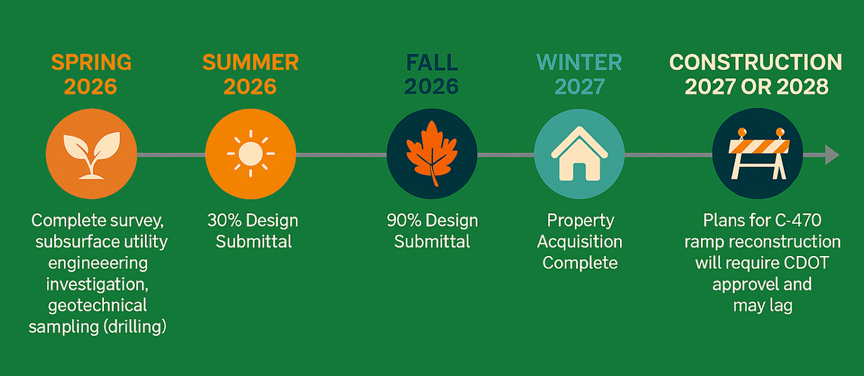
Traffic Impacts
The project is currently in the planning and design phase. When construction begins in 2027, Grigs Road will be fully closed to traffic. The closure will allow for earthwork to modify the roadway alignment and grade, as well as excavation to install stormwater inlets and culverts. A full closure will also allow the contractor to operate on an accelerated schedule and complete the project more efficiently.
Concept Design
Grigs Road Phase 2 is currently in the planning and concept design phase. Several roadway and multi-use trail alignment options are being evaluated and presented for public review. The public is encouraged to submit comments on the proposed designs using the project comment form.
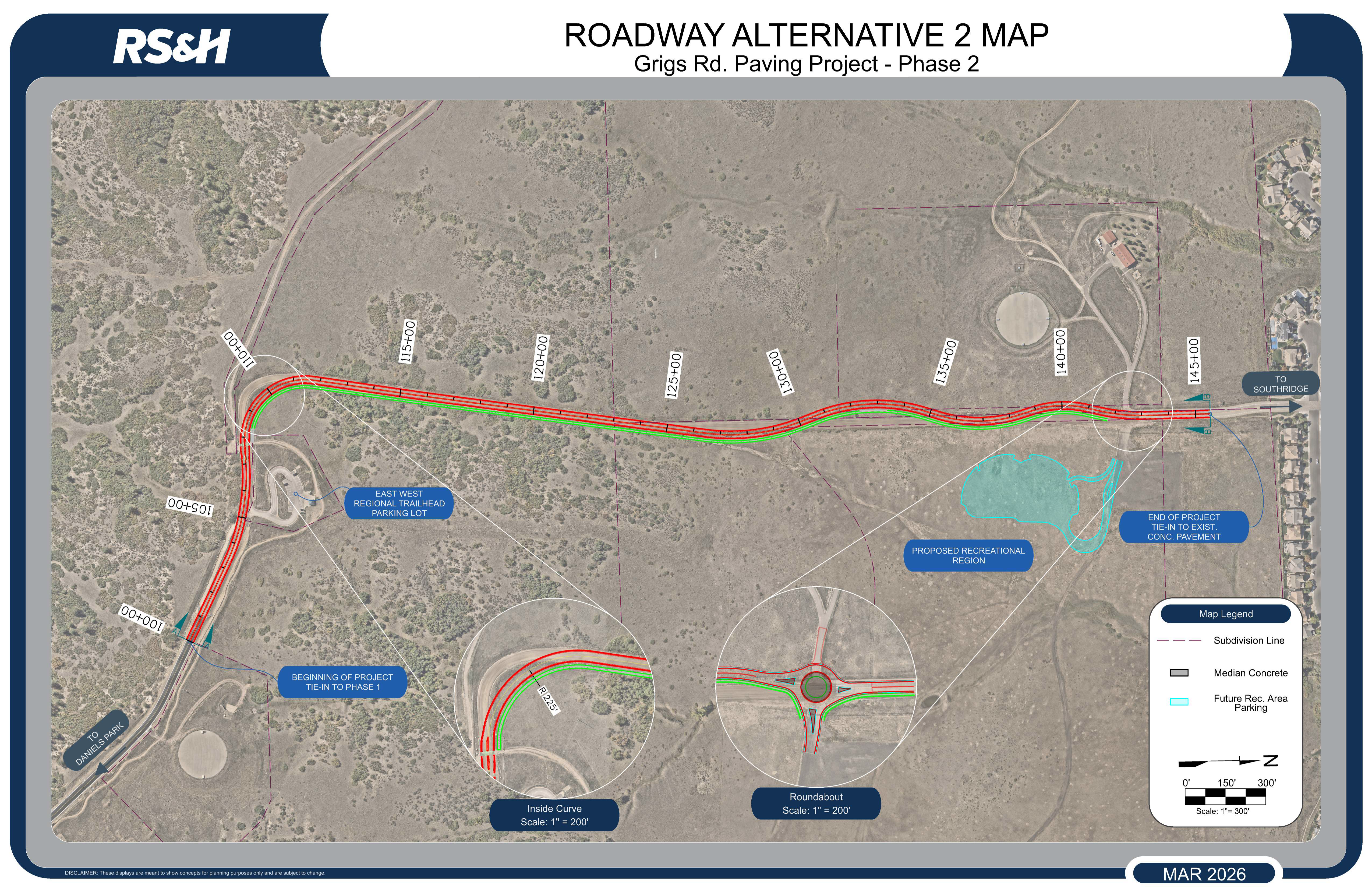
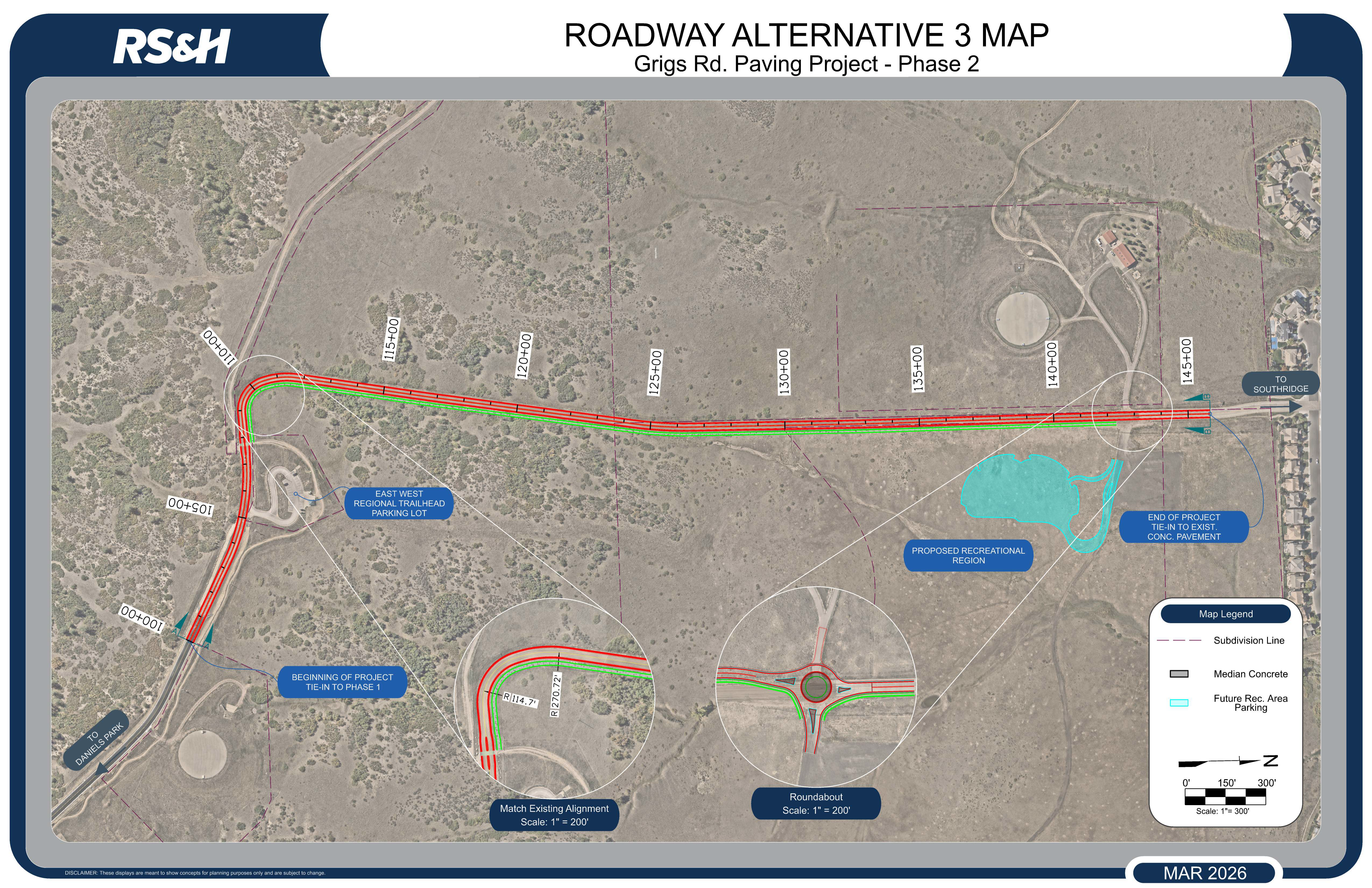
Roadway Exhibits
Several roadway and multi-use trail alignment options are being evaluated. Click any map to view high-resolution details.
Design Alternatives
Roadway Alternative 1
Features an "Outside Curve" alignment designed to address steep slopes near the trailhead.

Roadway Alternative 2
Utilizes an "Inside Curve" alignment to optimize the corridor.
Roadway Alternative 3
Explores a "Match Existing Alignment" strategy for the corridor connection.
Detached Trail Alternatives
Public Comment Form
Your feedback is vital to the success of this project. Please share your thoughts below.